![]() Smart Informatix Laboratory
Smart Informatix Laboratory
| Home | Research | Publications | People | Education | Job Openings | Contact |
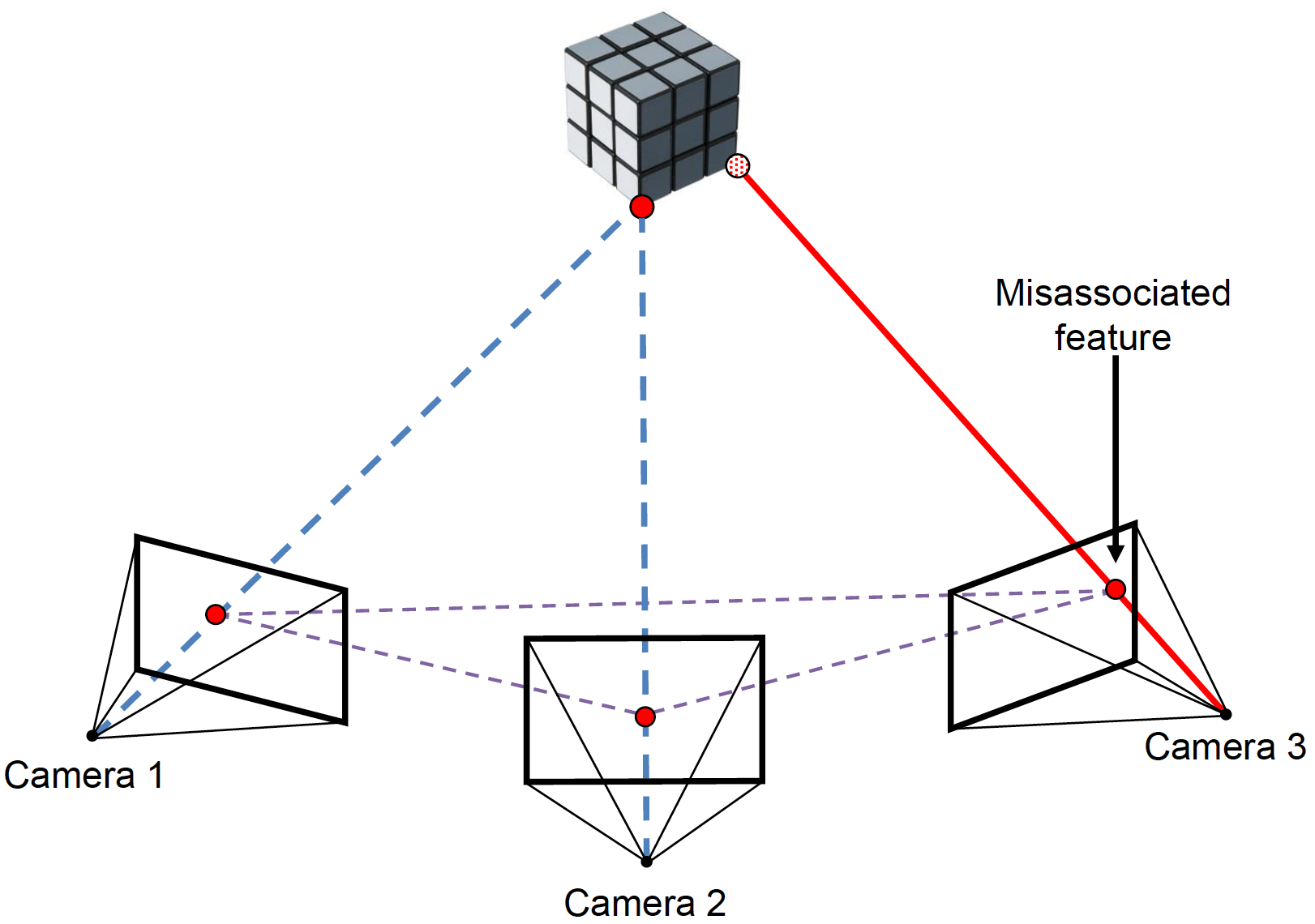
Robust 3D Scene Reconstruction in the Presence of Misassociated Features for Aerial Sensing
Georeferencing through aerial imagery has several applications, including remote sensing, real-time situational mission awareness, environmental monitoring, rescue and relief, map generation, and autonomous hazard avoidance, landing and navigation of Unmanned Aerial Vehicles (UAV). In aerial imagery, Structure from Motion (SfM) is often used for 3D point reconstruction (i.e., ground locations) and for camera pose estimation (i.e., airborne position and orientation) from a set of geometrically matched features between 2D images. We introduce an adaptive resection-intersection bundle adjustment approach that refines the 3D points and camera poses separately after the "gross" misassociations are removed by an outlier rejection algorithm. For each iteration, the proposed approach identifies the potential misassociated features independently in the resection as well as the intersection stage, where these potential outliers, contrary to previous studies, are reexamined at later iterations. In this way, maximum number of inlier matched features is retained.
 |
 |
Related Publication
Mohammad R. Jahanshahi, Fu-Chen Chen, Adnan Ansar, Curtis Padgett, Daniel Clouse and David Bayard, (2017), "Accurate and robust scene reconstruction in the presence of misassociated features for aerial sensing," Journal of Computing in Civil Engineering, American Society of Civil Engineers (ASCE), in press, Vol. 31, No. 6, November 2017.
| Copyright © 2014-2018 Smart Informatix Laboratory, Purdue University. All rights reserved. |