Slide 9 of 24
Notes:
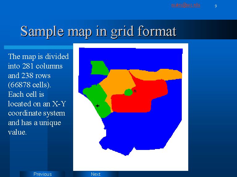
Once digitized, the maps are stored as shape files. In order to be able to collapse maps created by different people living into a specific area in order to create an average map, vector maps were transformed into grid maps. Using the Spatial Analyst extension of ArcView each individual vector map was used for creating a cell based map, as indicated in slide 9. The size and the number of the cells was specified in Analysis Properties, so that all the maps will have exactly the same grid structure. Each cell inherits the value assigned to the vector map polygon is located in.