Research Activities
Current Research Interests || River Channel Research and Tools || Past Student Theses My group's broader area of interest is in the area surface water hydrology with specific focus on flood related processes. Some of our current research interests and activities are briefly described below. If you need additional information, please look at the publications page. To get live updates on what's going on with my research and teaching, follow me on Twitter.Flood Modeling and Mapping from Reach to Continental Scale
Floods cause more deaths and economic losses than any natural disasters globally. With the changing climate, both the severity and frequency of flooding are expected to increase. Additionally, land use change in the form of urban development and deforestation will also increase the magnitude of flooding in the future. Accurate forecasting of the flood magnitude and corresponding inundation extent are key to understand the flood risk and avoid losses. Our research group has done a lot of work in the area of accurate modeling and mapping of flood extents, including quantifying the role of different uncertain elements and developing probabilistic flood mapping techniques. We are also working to create hyper-resolution flood modeling and mapping approaches that can provide flood inundation information for the smallest streams and streets in both rural and urban areas.
Floodplain Mapping Using Geomorphic Approaches
The conventional approach of flood modeling and mapping requires high quality input data and access to computational resources, which makes this approach challenging to implement in data and/or resource scarce regions. Topography in the form of Digital Elevation Model (DEM) is now available globally from different sources. DEM can be used to derive several topographic attributes, such as the wetness index, slope and height above the nearest drain, which can be used to map the floodplain. Similarly, soil data can also be used in conjunction with topography to map historically flooded areas by using their taxonomic description and drainage related attributes. While floodplain mapping using geomorphic approach is simple, its application requires training data in the form of floodplain maps, which are not always available in data scarce regions. We are developing simple statistical models that will enable large scale floodplain mapping in data scarce regions without dependence on existing floodplain maps or fine resolution data.
Development of Cyberinfrastructure to Enable Collaborative Hydrology Research and Education
With the rapid advances in the area of cyber technology and the emergence of big data, there is tremendous potential to embrace these developments to advance hydrologic science and education. We collaborate with the ITAP Research Computing at Purdue to develop cyberinfrastructure for collaborative hydrologic modeling. One of the products from this collaboration is SWATShare, which is also a part of the larger collaborative HydroShare project funded by the National Science Foundation. Similarly, in collaboration with the Science Education Resources Center (SERC) at Carleton College, we have developed a collaborative cyber environment to publish and share educational modules that use digital data and tools to explore hydrology concepts.
Improved Representation of Hydrologic Fluxes in Simulation Models
Commonly used hydrologic models in practice and research utilize conceptual or empirical equations to compute hydrologic fluxes. Most often, these models are calibrated against observed streamflow to give reasonable streamflow output, but other fluxes such as soil moisture and evapotranspiration are incorrectly computed by these models. Additionally, the parameters that are used to compute these fluxes lose their physical meaning during model calibration using streamflow data. One way to address this issue is by using physically based models, but the data needed to create an accurate physically based model are not always available, thus limiting their application. Another approach is to assimilate earth observations in hydrologic models to improve the representation of hydrologic processes to provide better prediction. Our group is working on tools to extract and process earth observations for use in Soil and Water Assessment Tool (SWAT) for better simulation of hydrologic processes in the Mississippi River Basin. The products from this work can be applied for any other basin around the world.
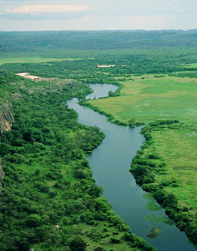
River Channel Research and Tools
Improved understanding of river hydrodynamics is critical for managing river flows and floods. An important dataset needed for simulating hydrodynamics is the river bathymetry to characterize the riverbed topography. Collecting river bathymetry is resource intensive, and these data are difficult to obtain for most rivers. Many river bathymetry datasets are available in the form of cross-sections collected for creating 1D hydraulic models. Our group has been working to develop tools and techniques for creating synthetic river bathymetry for use in 1D and 2D hydrodynamic models. These tools can be downloaded from the links below.| Name | Description | Download |
|---|---|---|
| Bathymetry Interpolation | This tool interpolates channel cross-sections to create a bathymetry mesh for the main channel. Contact me by email if you want the ArcGIS 9.x version of this tool. | ArcGIS 10.x Version ArcGIS 10 Version |
| RCMM | River Channel Morphology Model (RCMM) can create a 3D channel from a blue line. The channel description from RCMM can be used to run HEC-RAS. The tool is developed for ArcGIS 9.0 and higher | RCMM.zip |
| Bank Delineation | The bank delineation tool takes an aerial photograph and the channel centerline as input, and automatically creates a boundary polygon for the channel. | Delineation.zip |
| Cross-section and Thalweg | In traditional cross-section surveys, a cut-line across a river is defined, and the elevations are measured along this line. Such a technique provides a series of pairs of (m,z) values, where m is the distance along the cut-line measured from the left bank (looking downstream), and z is the elevation. This tool creates 3D cross-sections and thalweg using cutlines and associated (m,z) values. | 3D CrossSections.zip |
| Channel Toolbar | This toolbar has functions for (1) creating a thalweg using a set of bathymetric (x,y,z) points, and (2) assign (s,n) coordinates to (x,y,z) points. In the (s,n) coordinate system, the channel is represented with respect to the flow direction, where s is the distance along the channel and n is the distance across the channel. | Toolbar.zip |
| Fish Habitat Tool | The fish habitat modeling tool combines the results of the hydraulic model (flow velocity and depth for a given flow) and the biological sampling statistics (habitat conditions described in terms of flow velocity and depth) to determine the spatial extent of available hydraulic mesohabitat and the available hydraulic habitat for individual fish species at a given flow-rate. | FishHabitat.zip |
2014
- Impact of Anthropogenic Activities on Hydroclimatological Variables PhD thesis by Kuk-hyun Ahn
- Investigating the Role of DEM Resolution and Accuracy on Flood Inundation Mapping MS thesis by Siddharth Saksena
- Floodplain Mapping using Soil Survey Geographic (SSURGO) Database MS thesis by Nikhil Sangwan
- Drought Policy Development and Assessment in East Africa Using Hydrologic and System Dynamics Modeling MS thesis by Lauren Gies
2011
- Prioritizing Levee Improvements MS Thesis by Brian Meunier
- Soil Moisture Data Assimilation at Multiple Scales and Estimation of representative field scale Soil Moisture Characteristics PhD thesis by Eunjin Han
- Uncertainty in Flood Inundation Mapping PhD thesis by Younghun Jung
- Object–oriented Hydrologic Modeling with GIS PhD thesis by Kwangmin Kang
- Land Use Land Cover Change and Atmospheric Feedback: Impact on Regional Water Resource PhD thesis by Sanjiv Kumar
- Regional regression equations to estimate synthetic unit hydrograph parameters for Indiana. MS Thesis by Jared Wilkerson.
- Studying the effect of spatial scaling on hydrologic model calibration using Soil Water Assessment Tool. MS Thesis by Sanjiv Kumar.
- Comparison of one-dimensional HEC-RAS with two-dimensional FESWMS model in flood inundation mapping MS Thesis by Aaron Cook.